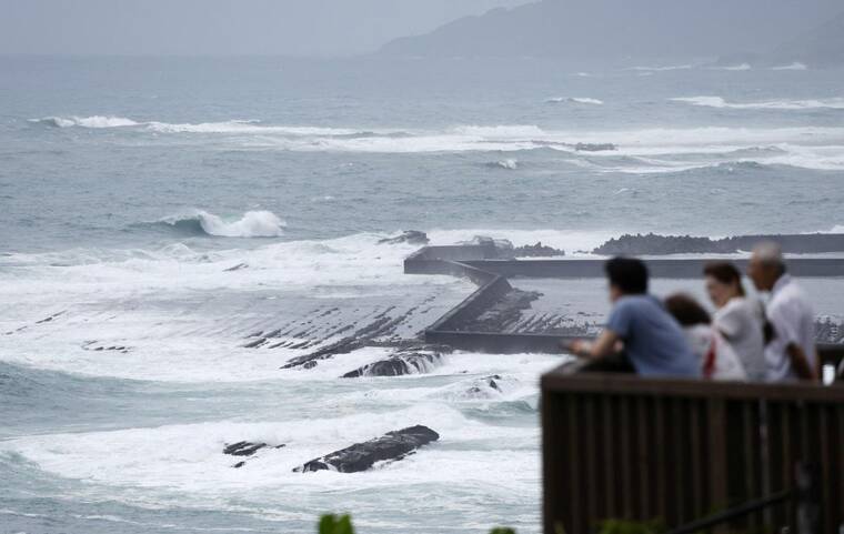
Typhoon Shanshan approaches Japan, bringing heavy rain, winds

KYODO/VIA REUTERS
High waves are observed along the shore as Typhoon Shanshan approaches southwestern Japan in Miyazaki, today, in this photo taken by Kyodo.
Typhoon Shanshan was churning toward southwestern Japan on Tuesday, bringing torrential rain and strong winds, forcing some flight cancellations and disrupting the country’s high-speed rail network.
The powerful storm had sustained wind gusts of up to 120 mph early today, equivalent to a Category 3 hurricane, according to the U.S. Navy’s Joint Typhoon Warning Center.
As the typhoon slowly approaches the Amami Islands, an archipelago southwest of Japan’s mainland, it is expected to dump up to 16 inches of rain on the islands from midday Tuesday to midday Wednesday, the Japanese Meteorological Agency said. Later in the week, parts of western Japan may receive nearly 2 feet of rain within 24 hours. The agency warned of the potential for widespread floods and landslides.
After approaching the Amami Islands, the storm is predicted to shift north Wednesday and approach Kyushu, one of Japan’s main islands, by Thursday. It may make landfall in Kyushu, the agency said, but forecasters are uncertain about its exact path.
Because the typhoon is moving slowly, the Amami region and western Japan will experience long periods of violent or very strong winds and rain, the agency said.
Winds of up to 90 mph were forecast in southern Kyushu and the Amami region starting today, and could increase to 110 mph Wednesday.
Don't miss out on what's happening!
Stay in touch with breaking news, as it happens, conveniently in your email inbox. It's FREE!
If the typhoon speeds up after landfall, it could exit swiftly up the spine of the country and weaken over the rugged mountains. But the storm could have even more severe effects if it stalls right at landfall, hangs around for a few days or spins back south.
Japan Airlines said that it had canceled some Wednesday flights arriving and departing from parts of central Japan, including from Osaka Kansai Airport, one of the country’s biggest airports. All Nippon Airlines, the country’s largest airline, said that the storm was expected to affect some flights at Osaka airport.
The country’s high-speed rail network, the Shinkansen, began to cancel some services starting today. The cancellations may last until the weekend, its operators warned.
The start of the Pacific Ocean typhoon season this year has seen a lower number of tropical storms than average, in part because of the La Nina weather pattern that is predicted to arrive later this summer, according to the National Weather Service.
La Nina, which is defined by cooler equatorial sea surface temperatures, typically increases wind shear — changes in wind speed and direction — in the central Pacific region, which makes it harder for storms to develop, the weather service said in May.
Still, forecasters said today that several other tropical storms were brewing in the region near Hawaii, including Hone and Hector, though none were close enough to threaten the island.
Gilma, another storm in the region with Category 2 hurricane wind speeds, reached the Central Pacific basin today, according to the National Hurricane Center. The storm is whirling toward Hawaii and threatening to bring rainfall, but it is too early to know if it will pass over the islands or near them this week.
>> RELATED: Weakening Gilma seen having ‘minimal impact’ for Hawaii
Between May and July, the region saw three tropical storms, two typhoons and one major typhoon, according to the National Oceanic and Atmospheric Administration. The average for that period between 1991 and 2020 is about eight tropical storms, about four typhoons and two major typhoons.
This article originally appeared in The New York Times.
© 2024 The New York Times Company


