Weakening Gilma continues to dissipate
CENTRAL PACIFIC HURRICANE CENTER
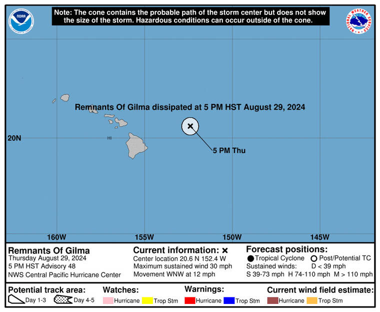
The 3-day forecast track of Tropical Depression Gilma.
UPDATE: 5 p.m.
Gilma continued to dissipate this afternoon. With maximum sustained winds of 30 mph, the remnants of Gilma were located about 185 miles east-northeast of Hilo and about 360 miles east of Honolulu as of 5 p.m.
The remnants are moving toward the west-northwest near 12 mph, and this motion is expected to continue over the next couple of days.
The Central Pacific Hurricane Center has issued its last advisory on the dissipated Gilma.
National Weather Service forecasters said Honolulu will see scattered showers on Friday and Saturday with light winds, highs about 85 degrees and a 50% chance of precipitation.
11 a.m.
Don't miss out on what's happening!
Stay in touch with breaking news, as it happens, conveniently in your email inbox. It's FREE!
Tropical Depression Gilma is expected to become a post-tropical cyclone soon as it moves closer to the Hawaiian Islands.
As of 11 a.m. today, Gilma was located about 225 miles east of Hilo and about 405 miles east of Honolulu, packing maximum sustained winds of 35 mph with higher gusts and moving west-northwest at 12 mph.
Gilma is expected to continue in the general motion through Saturday when it will dissipate north of Kauai. Forecasters predict Gilma to continue weakening to a remnant low by tonight.
EARLIER COVERAGE
Tropical Depression Gilma continues to weaken as it nears the Hawaiian Islands, with meteorologists predicting the storm will soon become post-tropical.
As of 5 a.m. today, Gilma was centered approximately 285 miles east of Hilo, moving west at 14 mph, according to the Central Pacific Hurricane Center. The storm’s maximum sustained winds have decreased to 35 mph, with higher gusts.
Forecasters expect Gilma to turn slightly northwest on Friday as it approaches the islands. The depression is predicted to weaken further, becoming a remnant low by tonight. The system is likely to dissipate near Kauai by Saturday.
No coastal watches or warnings are in effect, but residents are advised to stay updated as the remnants of Gilma may still bring adverse weather to the area.
Meanwhile, the remnants of former Tropical Depression Hector have dissipated. As of 11 p.m. Wednesday, Hector was located about 1,305 miles east of Hilo, with maximum sustained winds of 35 mph, according to the National Hurricane Center. The remnants are moving west at 13 mph and are expected to continue this motion for the next couple of days.
The NHC has issued its final advisory on Hector, as the system is no longer a threat.
A surface ridge of high pressure far north of the Hawaiian Islands will maintain moderate to fresh tradewinds today, bringing periods of showers, particularly to windward and mauka areas, according to the National Weather Service.
As Tropical Depression Gilma and the remnant low of Tropical Storm Hector pass near the state, expect enhanced rainfall, starting as early as tonight and potentially persisting through the weekend.


