Coastal flooding expected statewide during high tides

CRAIG T. KOJIMA / CKOJIMA@STARADVERTISER.COM
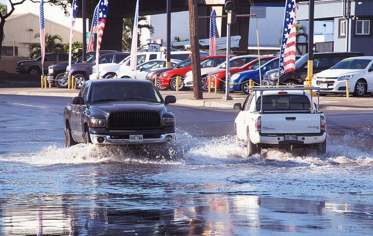
King Tides on Ahua St. in Mapunapuna in November 2017. The National Weather Service warns of coastal flooding for all Hawaiian isles, effective through Sunday.
The National Weather Service warns of coastal flooding for all Hawaiian isles, effective through Sunday.
The flooding is likely to occur during peak afternoon high tides, particularly along shorelines and low-lying coastal areas of all isles.
“Higher-than-predicted water levels combined with near-peak monthly tides and a south swell moving through could lead to minor coastal flooding through the weekend,” said NWS in the coastal flood statement. “This combination could lead to water sweeping across areas of the beach that typically remain dry during afternoon high tides.”
The public is advised to avoid driving through flooded roadways, and to move electronics, vehicles or other valuables to higher ground — and secure canoes or other watercraft stowed on beaches.
Boaters should also monitor vessels to ensure mooring lines are not too tight, and watch for overwash around boat ramps.
The University of Hawaii Sea Grant College Program, meanwhile, welcomes the submission of coastal flooding photos from the public for its study at PacificIslandsKingTides.org.
Don't miss out on what's happening!
Stay in touch with breaking news, as it happens, conveniently in your email inbox. It's FREE!


