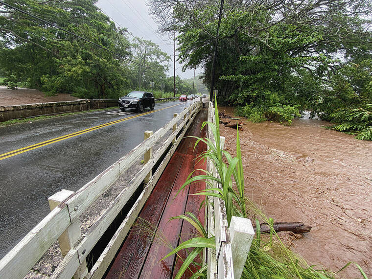
Windward Oahu was pummeled Monday by a slow-moving, heavy rainstorm that flooded streams, closed roads, triggered mudslides and caused general havoc for traffic and commerce.
And while the precipitation was expected to diminish overnight, the storming and potential for flash flooding isn’t quite done yet.
The National Weather Service said Monday that a larger Kona-low storm is expected to hit the islands Wednesday, unleashing the potential for thunderstorms, gusty wind, heavy rain and flooding through the weekend.
Officials said it was unstable conditions and a low-level southeast flow that brought flash flooding to Windward Oahu on Monday, dumping 5 to 9 inches of rain over a 12-hour period. Rain gauges recorded some of the largest deluges in Kaneohe and Maunawili.
The Waiahole Poi Factory on Kamehameha Highway was forced to close at midday when the Waiahole Stream topped its banks.
“We made it through the last couple of days, but today (the stream) just couldn’t hold it,” said Leinaala Cruz, administration manager at the roadside establishment.
About a foot of water found its way into the building and didn’t recede for at least a couple of hours, Cruz said.
Cruz said the decision to close down was already made in the late morning after the business received an alert from the U.S. Geological Survey gauge measuring the water level in the stream.
The same kind of flood swamped the Waiahole Poi Factory twice in one week a few years ago, she said, a hazard when you’re located next to the Waiahole Stream.
The plan, she said, is to clean up the property today and reopen Wednesday, weather permitting. The whole episode, she said, will probably cost the business an estimated $10,000 in revenue.
“Hopefully, none of our equipment was damaged,” she said.
Road crews from both the city and state were out in force Monday, closing roads and cleaning debris all over Windward Oahu.
In addition to Kamehameha Highway at Waiahole and Waikane Valley, officials closed both lanes on the town-bound side of Kalanianaole Highway at Kapaa Quarry Road due to a landslide. They also shut down the Halekou Interchange, the ramp from the H-3 freeway to Kamehameha Highway.
The state Department of Transportation closed the Kailua-bound right lane of Pali Highway after the second tunnel following a mudslide, and heavy rain led to the closure of Loop Road in Maunawili near the Auloa Bridge, according to the City and County of Honolulu’s Department of Emergency Management. The flooded bridge over Maunawili Stream was deemed dangerous to motorists.
Flash flooding also brought rocks and debris to Kaneohe Bay Drive, officials said.
Scattered periods of heavy rain drenched other parts of the island later in the day. The moisture, weather officials said, comes from a weather system that has lingered around the archipelago since late last week.
Forecasters said they were expecting rainfall rates to decrease overnight, but some showers are likely to persist as an upper-level low north of the state continues to generate unstable conditions over the islands.
A surface trough over the western end of the state will bring light southeast- to-south winds today, they said, but overall the weather pattern is likely to look much like Monday, with the exception of the wind direction. Showers will continue to be slow-moving, so periods of heavy rainfall will still be possible today, especially during the afternoon in interior and mountain locations.
Forecasters said a more widespread rainstorm is expected in the second half of the week when a strong Kona low develops north of the state and deep tropical moisture moves in from the south, generating powerful thunderstorms, gusty wind and flash flooding, especially over leeward parts of the islands.
A flood watch was issued for the entire state from Wednesday through Friday and likely will be extended over the weekend for Oahu and Kauai due to additional heavy rain expected to move into the western part of the state.
“Long story short, this is a strong Kona low event that will last for many days,” Monday’s forecast said.


