Magnitude-4.0 earthquake shakes Hawaii island
COURTESY USGS
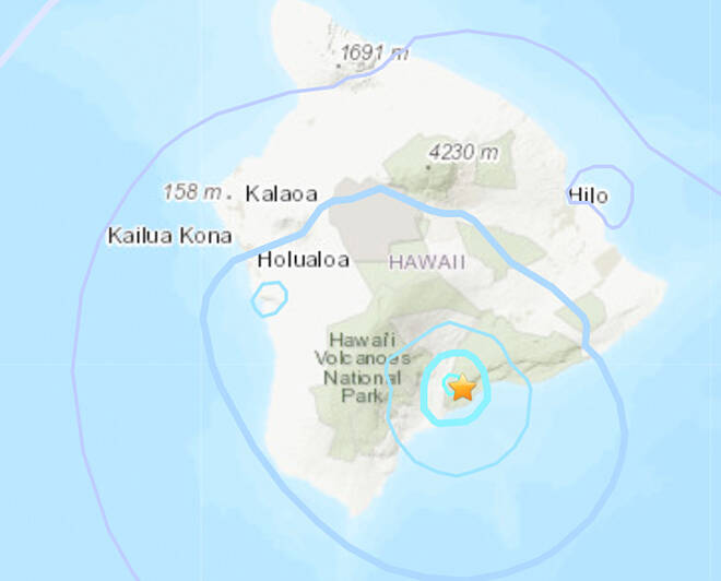
This U.S. Geological Survey map shows the location of a magnitude-4.0 earthquake that struck this afternoon about 7 miles east-northeast of Pahala on the southeast side of the Big Island.
A magnitude-4.0 earthquake was felt by Hawaii island residents at 2:23 p.m. today, but officials said the temblor was too weak to cause major damage.
The quake occurred 7 miles east-northeast of Pahala at a depth of 20 miles below sea level. It had no apparent effect on Mauna Loa or Kilauea volcanoes, according to a news release from the U.S. Geological Survey.
Aftershocks are possible in coming days to weeks, USGS officials said.
The earthquake was part of the seismic swarm under the Pahala area that has been occurring since 2019, they said.
0 Comments
By participating in online discussions you acknowledge that you have agreed to the Terms of Service. An insightful discussion of ideas and viewpoints is encouraged, but comments must be civil and in good taste, with no personal attacks. If your comments are inappropriate, you may be banned from posting. Report comments if you believe they do not follow our guidelines.
Having trouble with comments? Learn more here.
Please log in to comment


