Tropical Storm Estelle continues weakening far from Hawaii

NATIONAL HURRICANE CENTER
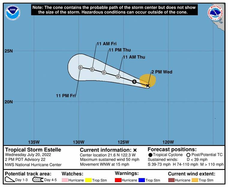
The 5-day forecast track for Tropical Storm Estelle.
Tropical Storm Estelle is weakening as it moves west-northwest towards the Hawaiian islands at about 15 mph, according to the National Hurricane Center in Miami.
At 11 a.m., the center of Estelle was about 2,115 miles east of Hilo, with maximum sustained winds of 50 mph and moving west-northwest at 15 mph. This general motion is expected to continue for the next few days, officials said, with a gradual decrease in forward speed.
Estelle is forecast to become a post-tropical remnant low on Thursday.
Tropical-storm-force winds extend outward up to 80 miles.
The National Weather Service of Honolulu, meanwhile, says moderate to locally breezy tradewinds will prevail through the week, along with a typical summertime weather pattern.
Trades will focus modest showers over windward slopes, but rainfall at most sites will be less than a quarter of an inch each day, with pockets of moisture periodically boosting rainfall.
Don't miss out on what's happening!
Stay in touch with breaking news, as it happens, conveniently in your email inbox. It's FREE!
Surf is expected to remain low on all shores, with the current south swell continuing to decline and expected to lower from 4 to 6 feet today to 2 to 4 feet on Thursday.
Only a small craft advisory remains in place for Maalaea Bay, the Pailolo and Alenuihaha channels, and Hawaii island leeward and southeast waters through 6 p.m. Thursday.


