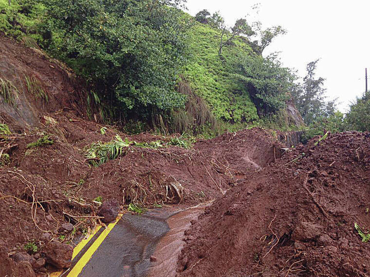
The April 2018 flooding from a massive storm over Kauai caused $180 million in damage, wrecked hundreds of homes and unleashed landslides that cut off the island’s north shore communities for months.
The storm dropped nearly 50 inches of rainfall in a 24-hour period, shattering the previous 24-hour U.S. rainfall record of 42 inches set in Texas nearly 40 years earlier.
University of Hawaii scientists have now determined that supercell thunderstorms, reacting with the steep terrain on Kauai’s northern slopes, are to blame for the deluge.
Terrence Corrigan, a doctoral candidate, and professor Steven Businger, both in the Department of Atmospheric Sciences at the UH Manoa School of Ocean and Earth Science and Technology, sifted through reams of National Weather Service radar data over the past few years to reveal the anatomy of the storm.
Their analysis, detailed in this month’s issue of the Monthly Weather Review scientific journal, found that shifting lower-level winds collided with Kauai’s steep cliffs, forcing moisture skyward in powerful rotating updrafts.
When the moisture cooled aloft, a series of “rain bombs” fell on the area as the system was tethered to the terrain by the efficiently rotating updrafts.
Their observations suggest the configuration of the terrain, in combination with the wind shear, separated an area of updrafts from the downdraft section of the storm, resulting in nearly nonstop heavy rainfall over Waipa Garden — site of the rain gauge that collected 49.7 inches over a 24-hour period April 14-15.
“There was some heavy, heavy rainfall,” Businger said.
The rotating updrafts, a signature of supercell thunderstorms, make the storms more intense and longer lasting, he said.
More common in the
Midwest, supercell thunderstorms are the least common type of thunderstorm in Hawaii but they offer the greatest likelihood of generating severe weather, including hail, tornadoes and strong winds.
Businger said such intense storms could become more frequent in Hawaii as climate change drives up sea surface temperatures. For every degree of warming, 7% more water vapor is available to feed flash floods from such storms, he said.
“We haven’t seen the last of these events,” he said.
Interestingly, the Kauai storm was associated with a Kona-low weather system rather than the tropical cyclones featured in previous U.S. rainfall records.
Kona-low storms typically occur during the hurricane offseason and are linked to an area of low pressure that sets up west or northwest of the islands.
For Kauai, the 2018 storm was the worst disaster since Hurricane Iniki in 1992.
The severe flooding not only destroyed or damaged 532 homes, it caused a
series of landslides that left Kuhio Highway with some 32 emergency repair sites.
A 2-mile stretch of the
highway was closed to nonlocal traffic for more than a year.
A total of 49.7 inches fell at Waipa Garden in the
24-hour period ending at 12:45 p.m. April 15, breaking the previous U.S. record of 43 inches on July 25-26, 1979, near Alvin, Texas, from Tropical Storm Claudette.
Businger said he and
Corrigan plan to use high-resolution computer models to simulate the interaction between various wind flows and terrain configurations in an effort to learn more about the interaction of mountains and severe
thunderstorms.
“Understanding the
dynamic interaction of our tropical atmosphere and steep mountains will help weather forecasters better anticipate severe weather events and flash floods in our state and elsewhere,” Businger said.

