Lane’s turn west not assured, so next 24 hours will be crucial for Oahu, meteorologist says


COURTESY NOAA
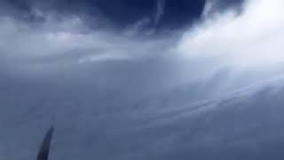
Lt. Cmdr. John Rossi flies NOAA’s WP-3D “Hurricane Hunter” aircraft on Tuesday.


The next 24 hours will be watched closely for a hoped-for weakening of Hurricane Lane from wind shear that would cause the giant swirling storm to take a nearly 90-degree turn to the west — avoiding a direct hit on Oahu, meteorologists said today.
At 5 p.m., Lane had weakened slightly and was 240 miles south of Honolulu, with maximum sustained winds of 120 mph, making it a Category 3 storm, the National Weather Service said.
But Richard Henning, a research meteorologist with the National Oceanic and Atmospheric Administration who made three flights into Lane this week in a WP-3D Orion “Hurricane Hunter,” said the storm is not weakening as much as it was earlier predicted it would.
“It will be bad news for Oahu if the storm tomorrow is stronger than (the Central Pacific Hurricane Center) has forecast right now — because that will make a turn to the left more unlikely before it gets to Oahu,” Henning said. “Everyone on Oahu should be prepared to take a direct hit.”
Hurricanes are big, nasty storms, “but their structure is actually quite delicate,” he said. Henning likens it to a stack of dishes, “and if you start pushing on the top of that stack, the whole thing falls over, and hurricanes are the same way.”
Wind shear destroys the vertical structure of the storm, “but Lane has actually shown that it’s very resistant to that wind shear,” holding an intensity that’s a lot stronger than anticipated just a couple days ago, according to Henning.
Don't miss out on what's happening!
Stay in touch with breaking news, as it happens, conveniently in your email inbox. It's FREE!
That left turn away from Oahu is dependent on Lane weakening enough from wind currents from surface level up to 30,000 feet to be steered away from Hawaii’s most populated isle.
Henning said there’s “low confidence” in the storm making a 90-degree left turn at the last minute. That said, National Weather Service meteorologist Maureen Ballard said Lane has been slowly weakening.
It could be that the storm “is so strong that it is resistant a little bit more,” Ballard said. “But we do still have a forecast trend of weakening to occur.”
“It is definitely something that we are watching very closely, and the Central Pacific Hurricane Center forecasters are very closely monitoring that track,” she said.
The next 24 hours in particular will be key, “because that’s around the time that we would expect (the hurricane) to start making that 90-degree turn,” Ballard said.
The sooner it makes that turn, the better off Oahu will be.
“If it goes a little bit farther north before it makes it, that means it comes closer to Oahu,” she said. “Everyone needs to be prepared, because there is some uncertainty in there.”
Ballard added that’s reflected in the cone track predicted for the storm, “and you see how wide it is … That’s where we’re looking at a lot of different factors in there.”
“That’s why we say, if you are in the cone, that indicates that the center of the storm could be anywhere in that cone …,” she said. “We’re trying to steer people away from the ‘skinny black line.’ That is the forecast track; however, the (wider) cone means that that line could be anywhere in that cone.”
Over the next 24 hours the hope is to “start seeing a little bit more of that westerly movement,” she said. “We’re not seeing it yet. But we would hope to start seeing some signs of that.”
Friday morning between pre-dawn and daybreak may bring Honolulu 40 mph tropical storm-force winds, with even stronger gusts as the storm gets nearer, Ballard said. The storm is expected to intensify after that.
Henning flew on three of four missions through the hurricane this week to gather research and tracking data.
He said he’s been flying the missions since 1995 and he has almost 250 hurricane “eyewall” penetrations, but a couple of the flights through Lane were among “the roughest flights I’ve ever been on.”
The storm was at Category 5 at the time with 160 mph winds. A Tuesday night-Wednesday morning pass “knocked us around really good,” he said. “We encountered 3 Gs, which is a lot for a P-3. We’re not a fighter plane. And we also encountered negative Gs, which literally makes everything fly that isn’t strapped down.”
In addition to the P-3, a NOAA Gulfstream IV also gathered storm-tracking information, along with an Air Force Reserve WC-130J from the 53rd Weather Reconnaissance Squadron in Mississippi. The NOAA planes are based out of Florida.
The planes and crews, flying out of Barbers Point and Daniel K. Inouye International Airport, have all left Hawaii ahead of Lane’s major impact on Oahu.
“There’s no place to safely store the aircraft,” said Dennis Feltgen, spokesman for the National Hurricane Center in Miami.


