Kilauea volcanic activity continues at fissure 8
U.S. GEOLOGICAL SURVEY
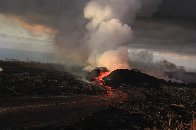
Fountains from the fissure 8 spatter cone continued to supply lava to an open channel today. The spatter cone is now about 180 feet tall at its highest point.
U.S. GEOLOGICAL SURVEY
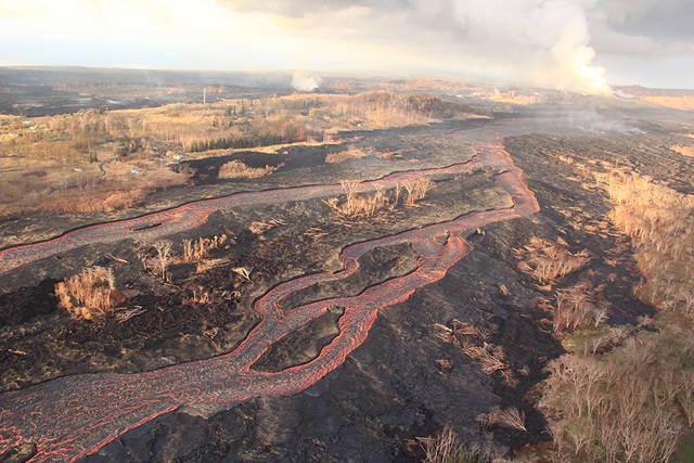
Lava from fissure 8 is fed into a channel that travels about 8 miles to the ocean. A plume marks the location of fissure 8, visible in the upper right; a small plume in the upper center marks the location of fissure 22.
U.S. GEOLOGICAL SURVEY
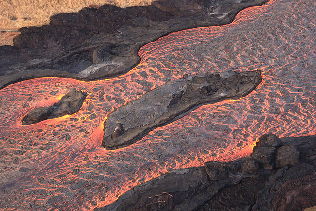
The direction of flow is from the upper right to lower left. Field crews can make a rough calculation of velocity by timing large blocks as they pass between two landmarks that are a known distance apart.
Fissure 8 is still active today and continues to feed a lava channel to the ocean at Kapoho.
Gas emissions from the eruption and laze at the ocean entry also continue to be very high.
Light winds will cause SO2 levels to rise as gases build up in affected areas, the National Weather Service reports.
Fissure 22 is also active and producing a short flow.
Just before 3 p.m. a gas explosion occurred at Halemaumau Crater, generating a 5.4 magnitude-equivalent earthquake.
There was no tsunami threat, according to the Pacific Tsunami Warning Center.
Don't miss out on what's happening!
Stay in touch with breaking news, as it happens, conveniently in your email inbox. It's FREE!
Drivers should still be on the lookout for cracks in the roadways due to volcanic activity.
Disaster assistance is available island-wide to those that have been affected by the Kilauea eruption.
>> You can register for disaster assistance with the Federal Emergency Management Agency (FEMA) by visiting the Disaster Recovery Center, calling 1-800-621-3362 (FEMA), or online at disasterassistance.gov Opens in a new tab.
>> The Disaster Recovery Center is open daily from 8 a.m. to 8 p.m., located at the Keaau High School Gym. If you need a ride, buses will resume running between the two shelters and the Disaster Recovery Center between 7:30 a.m. and 9 p.m.
>> For more information, visit http://www.hawaiicounty.gov/
Kilauea lower East Rift Zone lava flows and fissures, June 30 by Honolulu Star-Advertiser on Scribd
Given the dynamic nature of Kīlauea’s lower East Rift Zone eruption, with changing vent locations, fissures starting and stopping, and varying rates of lava effusion, map details shown here are accurate as of the date/time noted. Shaded purple areas indicate lava flows erupted in 1840, 1955, 1960, and 2014-2015. (see large map)