Flash flood watch posted for entire state as winter storm moves west
MAUNA LOA OBSERVATORY
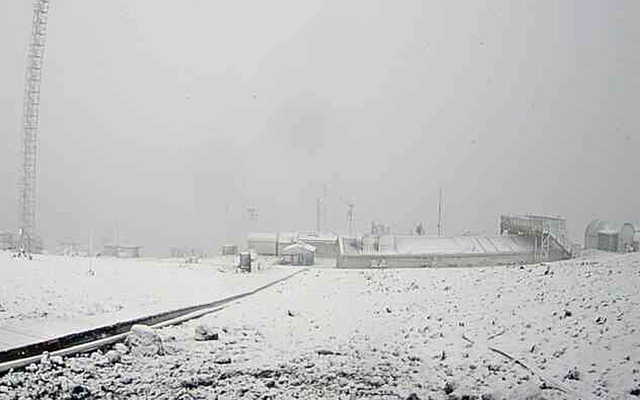
This webcamera image looking toward Mauna Kea shows snow on the ground and heavy clouds over Mauna Loa.


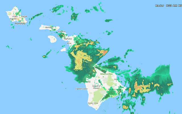
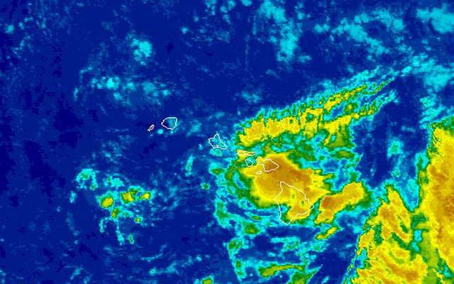
A winter storm is bringing a chance of heavy rain and flooding to the islands and snow to the summits of Mauna Kea and Mauna Loa.
The National Weather Service posted a flash flood watch for the entire state and a winter storm warning for Big Island summits this morning.
“The flash flood threat will initially be highest over the Big Island, but will spread to the smaller islands later today, tonight and Saturday, then persist through the weekend,” forecasters said.
The watch is in effect until Sunday afternoon.
“It’s not going to rain heavily all the time at every spot, but there’s going to be pockets of heavy rain over the next few days,” said Robert Ballard, a meteorologist with the Honolulu office of the National Weather Service.
Forecasters said a foot of snow could fall at the summit through Friday. Webcamera images showed heavy clouds and fog on Mauna Kea and Mauna Loa along with snow already on the ground.
Don't miss out on what's happening!
Stay in touch with breaking news, as it happens, conveniently in your email inbox. It's FREE!
In addition, winds of 25 to 40 mph with gusts to 50 mph are blowing at the summit and freezing fog is limiting visibility.
The forecast for the state calls for mostly cloudy and breezy conditions today with frequent windward and mauka showers and scattered leeward rains.
There is a chance of thunderstorms and lightning strikes across the state.
The rains over the Big Island this morning are expected to move over Maui and Oahu by this afternoon with the greatest chance of heavy rain tonight into Friday.
“The highest flood threat is going to be windward and mauka, but we can’t really rule it out on the leeward side,” Ballard said.
He noted that steady rains over windward areas over the last week have saturated the ground, so it may not take much more rain to cause flooding.
Tradewinds continue to be breezy today at 15 to 25 mph and higher gusts.
The winds will shift to the southeast by Saturday, bringing continued wet, humid weather and the chance of vog to Oahu, although the rains may washout the volcanic haze.
Forecasters said the muggy Kona weather conditions will continue into next week and there is a chance of another band of moisture moving over the islands and bringing more heavy rain later in the week.
10 responses to “Flash flood watch posted for entire state as winter storm moves west”
Leave a Reply
You must be logged in to post a comment.


Sounds like no golf-time to snuggle up with the wife.
Can watch Tiger on the tube instead.
Good time to wash the car.
I hope the City has the streams cleared. I saw the Manoa stream is ready to flood again.
Yes, State and City road maintenance should also be cleaning the surround areas of drains.
Cold and heavy rain in Hilo!
When or if this heavy rain comes to Oahu – Drivers / commuters beware! Be kind.
Oh great. Now traffic is going to continue to be bad!
come on all you antiTMT people, get on up there, wearing your traditional loincloth and tapa
Lucked out again here in W
Lucked out again here in West Hawaii, clear blue sky with lots of sunshine.