Tradewinds start to return as Lester moves away

CENTRAL PACIFIC HURRICANE CENTER
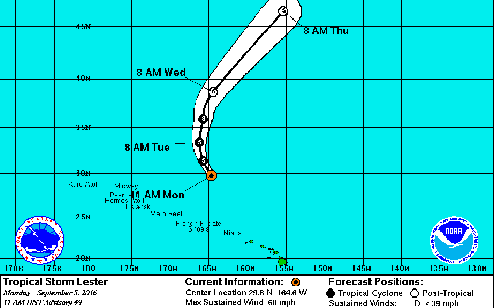
This graphic shows the projected path and intensity of Tropical Storm Lester at 11 a.m.

NOAA / NATIONAL WEATHER SERVICE
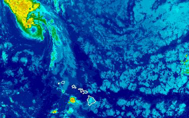
This satellite image taken early this morning shows Tropical Strorm Lester moving away from Hawaii and a line of rain clouds trailing behind it norrthwest of the islands. Other rain clouds are being blown in by tradewinds.


Tradewinds are beginning to return as Tropical Storm Lester continues to weaken and move away from Hawaii.
The National Weather Service said the humid conditions trailing behind Lester are also moving away from the islands.
The forecast today calls for brisk, east tradewinds of 15 to 20 mph with higher gusts, bringing the usual windward and mauka showers. Highs will be between 85 and 90 degrees.
“Typical trade wind weather is expected to prevail across the area through the middle of the week,” forecasters said. “Trade showers may become more active toward later part of the week,”
At 11 a.m., Lester was about 720 miles northwest of Honolulu with maximum sustained winds of 60 mph, moving northwest at 13 mph.
The storm is expected to be absorbed into another weather system moving toward the mainland and could bring rains to the Pacific Northwest next weekend.
Don't miss out on what's happening!
Stay in touch with breaking news, as it happens, conveniently in your email inbox. It's FREE!
The lingering tropical moisture from Lester brought isolated heavy showers to areas across the state on Sunday.
Saddle Quarry on the Big Island got a little more than 2.9 inches of rain. Puu Kukui on Maui saw 1.8 inches; Lanai got 2.63 inches and the Molokai Airport recorded nearly 1.1 inches. On Oahu, Makaha Stream saw 0.9 inches; Poamoho and Schofield Barracks got about 8 inches; and Mount Waialeale on Kauai recorded more than 2.6 inches.
Surf along east shores declined to 4 to 6 feet on east shores of Oahu, below advisory levels. North shores continue to see a small bump from Lester of 3 to 5 feet and a south swell is beginning to roll in with surf rising to 3 to 6 feet today and 4 to 7 feet Tuesday.
2 responses to “Tradewinds start to return as Lester moves away”
Leave a Reply
You must be logged in to post a comment.


Of the tradewinds returning, Deo Gratias!
Just in time to go back to work.