Forecasters monitor 2 storm systems in East Pacific

UNIVERSITY OF WISCONSIN-MILWAUKEE
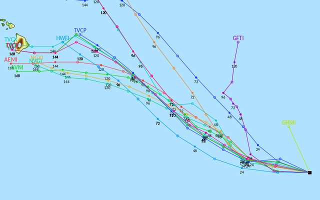
This graphic shows what different weather computer model projects of the path of a storm system in the East Pacific. The margin of error on the computer models is large when looking beyond three to five days. But some models show the storm passing over or near Hawaii.

NOAA / GOES WEST
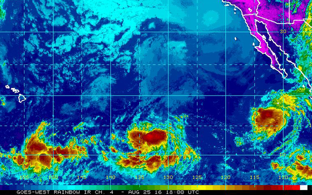
This composite satellite image shows an area of thunderstorms, lower center, that has an 80 percent chance of developing into a tropical depression over the next five days. Tropical Storm Lester, near Mexico, formed overnight.


Forecasters are watching two storm systems in the East Pacific that have the potential to bring high surf, and more muggy conditions and rain to Hawaii starting next week.
But the systems are still too far away to know if they will pass close enough to Hawaii to affect island weather.
One of the weather systems strengthened into Tropical Storm Lester overnight, according to the National Hurricane Center in Miami.
The other system, about 1,700 miles southeast of Hawaii island, has an 80 percent chance of developing into a tropical depression over the next five days, forecasters said today. If it develops into a tropical storm in the Central Pacific, it could be the first named storm of the Central Pacific hurricane season and would be called Ulika. If it becomes a storm in the East Pacific, it will be named Madeline.
Some computer models show the storm passing over or near the Big Island late next week. However, the margin of error on the models this far in advance is large.
Jeff Powell, the lead forecaster at the Honolulu office of the National Weather Service, said forecasters should have a better idea of the path of the closer system by early next week.
Don't miss out on what's happening!
Stay in touch with breaking news, as it happens, conveniently in your email inbox. It's FREE!
Meanwhile, Lester is packing sustained winds of 60 mph as it moved away from the coast of Mexico.
At 11 a.m., the storm was 470 miles south-southwest of Baja California, moving west-northwest at 10 mph.
Lester is forecast to strengthen into a hurricane this weekend. Depending on its path and the strength of the winds, the storm could send some surf to east shores of the Hawaiian islands next weekend.


