Wet weekend ahead as storm remnants move near Hawaii

NOAA/GOES WEST
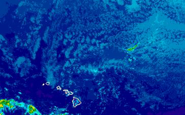
An area of low pressure and moisture associated with former Hurricane Georgette is northeast of the islands and is expected to bring an increase in rain this weekend through early next week.
Carry an umbrella to outdoor events this weekend.
An area of low pressure and increased moisture is moving near the islands starting tonight and will likely bring an increase in showers, especially in windward and mauka areas. But some of the rain will be blown over to leeward areas, National Weather Service forecasters said.
The low pressure will weaken the tradewinds and the tropical moisture, some of it associated with what’s left of former Hurricane Georgette, will move over the islands through early next week.
Matt Foster, a meteorologist with the Honolulu office of the National Weather Service, said the air will be muggy. But it won’t be as hot and uncomfortable because there will still be light trades and cloudy conditions should keep high temperatures in check.
Hilo tied a high temperature record for the date on Thursday. The high of 87 degrees matched the old record set just last year.
The forecast for tonight calls for mostly cloudy skies and scattered showers, increasing after midnight.
Don't miss out on what's happening!
Stay in touch with breaking news, as it happens, conveniently in your email inbox. It's FREE!
Trades are about 10 to 20 mph, dropping to 10 to 15 mph this weekend.
The forecast for Honolulu and south shores of Oahu calls for a 50 percent chance of scattered showers through the weekend and into Wednesday morning.
Remnants of former Hurricane Frank are also expected to move near the islands toward the middle or end of next week, bringing another increase in rain.
In the East Pacific, forecasters at the National Hurricane Center are watching yet another area of low pressure that has an 80 percent chance of developing into a tropical cyclone over the next five days.
3 responses to “Wet weekend ahead as storm remnants move near Hawaii”
Leave a Reply
You must be logged in to post a comment.


We needed Guy Hagi last Sunday to warn us about the severity of Darby.
Guess it’s now good for our drought conditions.
could use the rain