New photos released of lava entering ocean

USGS / HAWAIIAN VOLCANO OBSERVATORY
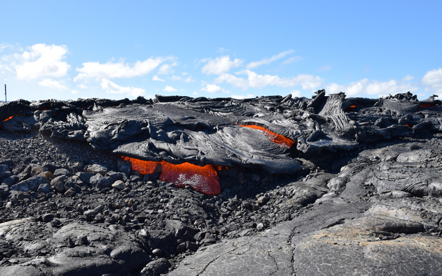
The flow front crosses to the ocean side of the emergency access road inside Hawaii Volcanoes National Park on Monday.
USGS / HAWAIIAN VOLCANO OBSERVATORY
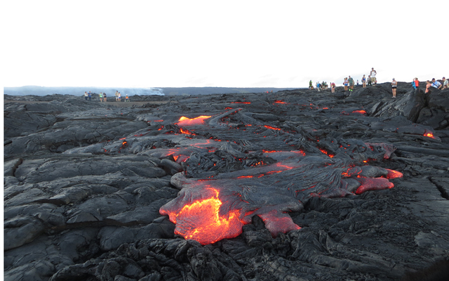
Tourists view the active lava flow in Hawaiian Volcanoes National Park after the flow crossed the emergency access road.
USGS / HAWAIIAN VOLCANO OBSERVATORY
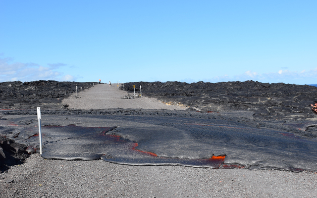
Flow 61G reached the emergency access road inside Hawaii Volcanoes National Park on Monday at 3:20 pm and crossed the road in about 30 minutes.
USGS / HAWAIIAN VOLCANO OBSERVATORY
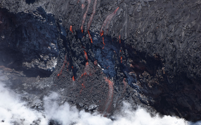
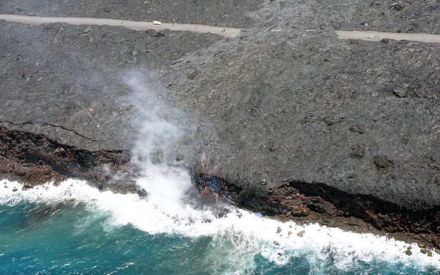
Several small fingers of lava went over a cliff into the ocean today Hawaii Volcanoes National Park.
USGS / HAWAIIAN VOLCANO OBSERVATORY
The narrow ocean entry of the 61G lava flow created a small plume of gas and steam during today’s overflight of the flow.
USGS / HAWAIIAN VOLCANO OBSERVATORY
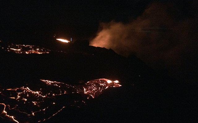
This photograph looks towards the ocean, from a spot along the west margin of the flow, showing the ocean entry plume just minutes after lava first reached the water Tuesday morning.
USGS / HAWAIIAN VOLCANO OBSERVATORY
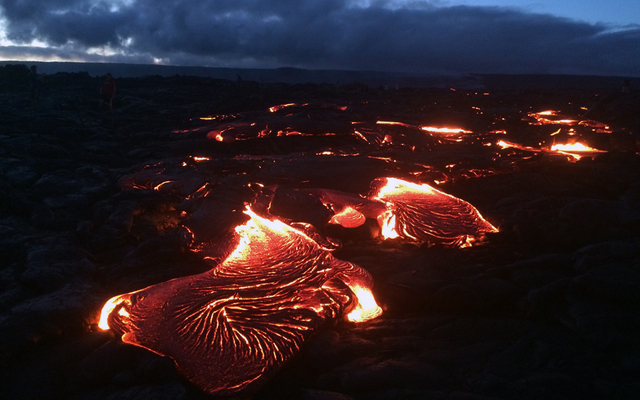
Geologists in the field Monday night observed lava crossing the stretch of land between the “emergency” gravel road and the sea cliff. This photograph shows the flow front a short time before lava reached the ocean.


Lava entered the ocean early Tuesday morning, just two months after the latest phase of the Kilauea eruption began.
The Hawaiian Volcano Observatory reports the 61G lava flow crossed the emergency access road in the Hawaii Volcanoes National Park on Monday and entered the ocean at 1:12 a.m.
The county built the gravel road, cutting through old lava flows to connect Highway 130 to Chain of Craters Road, at a cost of $5.1 million when the town of Pahoa was threatened by a lava flow in 2014. The Federal Emergency Management Agency covered 75 percent of the cost.
That flow stopped, just short of reaching Highway 130.
Jessica Ferracane, a spokeswoman for the Hawaii Volcanoes National Park, estimated about 200 to 300 people hiked to the flow as it crossed the road Monday afternoon and evening.
She said you can see the glow from the ocean entry from the access road and she expects more people tonight and in the coming days.
Don't miss out on what's happening!
Stay in touch with breaking news, as it happens, conveniently in your email inbox. It's FREE!
The current flow began on May 24 when lava began erupting from the northeast and east flanks of Puu Oo.
The northeast eruption faded and lava from the east vent reached the Pulama Pali on June 28.
The flow advanced about 2 miles along the coastal plain until reaching the ocean this morning.
Janet Babb, a spokeswoman for the Hawaiian Volcano Observatory, said the ocean entry is the first time lava has reached the ocean since August of 2013.
Babb said it is impossible to predict how long the ocean entry will last.
The last lava flow to enter the ocean, the Peace Day flow, made its first entry in 2011 and the ocean entry continued — off and on and in different locations — until 2013.
Ferracane said even though people can hike to the flow on the gravel road, the hike is not for everyone and people should be prepared with water, good shoes, appropriate clothing and flashlights if they are staying after dark.
“You still need to be a fit person,” Ferracane said. “It’s 10 miles round trip and there are no services.”
Observatory geologists warned visitors that there are significant hazards for people wanting to hike over lava to the area where the lava is entering the ocean.
“Venturing too close to an ocean entry exposes you to flying debris created by the explosive interaction between lava and water. Also new land created in unstable because it is built on unconsolidated lava fragments and sand. This loose material can easily be eroded away by surf causing the new land to become unsupported and slide into the sea.
Finally, the interaction of lava with the ocean creates an acidic plume laden with fine volcanic particles that can irritate the skin, eyes and lungs.”
Ferracane said if tradewinds are blowing, the lava plume tends to blow toward the park and away from the county access area on the other side of the flow.
Ferracane said the lava goes over a steep cliff before entering the ocean and there is a deep crack in the old lava on the western end of the flow front.
Rangers are placing signs to warn visitors about the hazards and extra rangers are stationed in the area.
Ferracane encouraged anyone going to the area from the Chain of Craters Road to check in at the Coastal Ranger Station, where information on safe lava viewing is available.


